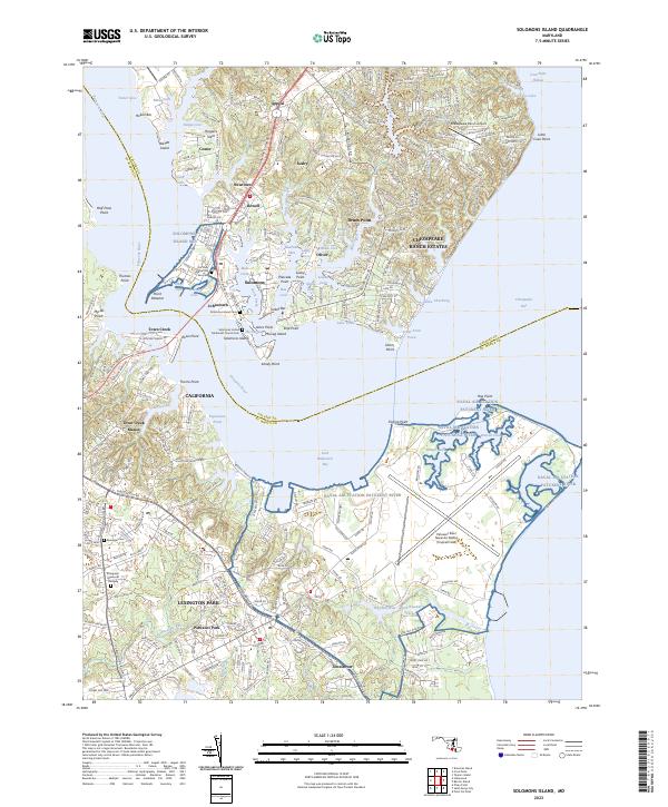
2023 Map of Solomons Island
USGS Topo · Published 2023About this map
The Patuxent River meets the Chesapeake Bay at this strategic Southern Maryland junction, where the deep waters of The Narrows separate Solomons Island from the mainland. The landscape is a complex network of protected coves and creeks, including Mill Creek and Back Creek, which have long supported the local maritime economy and the residential growth of Solomons, Dowell, and Olivet.
Find a feature on this map
205 named features on this map. Tap any name to fly to it.
Don’t see what you’re looking for? This feature index may not catch every label — zoom into the map to look around manually.
Map Details
Editions of this 2023 Solomons Island Map
This is the sole edition of this map. No revisions or reprints were ever made.
Other maps of this area

1892 · Leonardtown
USGS Topo · 1:62,500

1892 · Drum Point
USGS Topo · 1:62,500

1892 · Piney Point
USGS Topo · 1:62,500

1894 · Piney Point
USGS Topo · 1:62,500

1894 · Point Lookout
USGS Topo · 1:62,500

1895 · Leonardtown
USGS Topo · 1:62,500

1895 · Nomini
USGS Topo · 1:125,000

1895 · Piney Point
USGS Topo · 1:62,500

1898 · Nomini
USGS Topo · 1:125,000

1898 · St. Marys
USGS Topo · 1:125,000