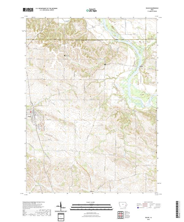
2022 Map of Solon
USGS Topo · Published 2022About this map
Solon serves as a primary hub within this rural Johnson County landscape, where the street grid of W Elm St and S Market St meets the open agricultural land of eastern Iowa. The terrain is defined by the winding course of the Cedar River as it flows south toward the settlement of Sutliff. This area preserves several traditional burial grounds essential for genealogical research, including Saints Peter and Paul Cem and Saint Marys Cem.
Find a feature on this map
65 named features on this map. Tap any name to fly to it.
Don’t see what you’re looking for? This feature index may not catch every label — zoom into the map to look around manually.
Map Details
Editions of this 2022 Solon Map
This is the sole edition of this map. No revisions or reprints were ever made.
Other maps of this area

1887 · Cedar Rapids
USGS Topo · 1:62,500

1891 · Mechanicsville
USGS Topo · 1:62,500

1891 · Cedar Rapids
USGS Topo · 1:62,500

1891 · Iowa City
USGS Topo · 1:62,500

1894 · Mechanicsville
USGS Topo · 1:62,500

1894 · West Liberty
USGS Topo · 1:62,500

1901 · Stanwood
USGS Topo · 1:125,000

1903 · Fairfax
USGS Topo · 1:125,000

1938 · Iowa City
USGS Topo · 1:62,500

1958 · Davenport
USGS Topo · 1:250,000