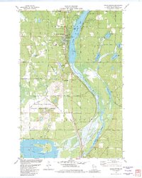
1982 Map of Solon Springs
USGS Topo · Published 1982About this map
Solon Springs serves as the focal point of this northern Wisconsin landscape, situated along the western shore of Upper St Croix Lake. The settlement is defined by its relationship to the water, with Lucius Woods State Park and a series of public access points lining the lakefront. To the south, the terrain transitions into the expansive Douglas County State Wildlife Area, a region of wetlands and forest managed for conservation.
Find a feature on this map
48 named features on this map. Tap any name to fly to it.
Don’t see what you’re looking for? This feature index may not catch every label — zoom into the map to look around manually.
Map Details
Editions of this 1982 Solon Springs Map
This is the sole edition of this map. No revisions or reprints were ever made.
Other maps of this area

1945 · Highland
USGS Topo · 1:48,000

1945 · Solon Springs
USGS Topo · 1:48,000

1947 · Chittamo
USGS Topo · 1:48,000

1947 · Minong
USGS Topo · 1:48,000

1949 · Solon Springs
USGS Topo · 1:48,000

1949 · Chittamo
USGS Topo · 1:48,000

1949 · Minong
USGS Topo · 1:48,000

1949 · Highland
USGS Topo · 1:48,000

1953 · Ashland
USGS Topo · 1:250,000
1954 · Lyman Lake
USGS Topo · 1:24,000