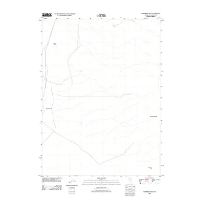
2011 Map of Sombrero Peak
USGS Topo · Published 2011About this map
Sombrero Peak rises at the southern edge of this Humboldt County landscape, serving as a prominent geographical anchor in a region defined by arid isolation and stark topographic relief. The terrain is characterized by the Slumbering Hills in the east and distinct volcanic or erosional forms such as Gabica Butte and Corbeal Butte. In 2011, this area remained largely undeveloped, with the map showing a sparse network of unpaved roads and 4WD tracks that navigate the high desert floor between these scattered peaks. The lack of named settlements or civic structures underscores the remote nature of this part of Nevada, where the primary human footprint is found in the utilitarian paths crossing the sagebrush plains toward the surrounding highlands.
Find a feature on this map
4 named features on this map. Tap any name to fly to it.
Don’t see what you’re looking for? This feature index may not catch every label — zoom into the map to look around manually.
Map Details
Editions of this 2011 Sombrero Peak Map
This is the sole edition of this map. No revisions or reprints were ever made.
Other maps of this area

1882 · Paradise
USGS Topo · 1:250,000

1886 · Disaster
USGS Topo · 1:250,000

1893 · Paradise
USGS Topo · 1:250,000

1893 · Disaster
USGS Topo · 1:250,000

1954 · Vya
USGS Topo · 1:250,000

1955 · McDermitt
USGS Topo · 1:250,000

1958 · Vya
USGS Topo · 1:250,000

1958 · Awakening Peak
USGS Topo · 1:62,500

1959 · McDermitt
USGS Topo · 1:250,000

1962 · Vya
USGS Topo · 1:250,000