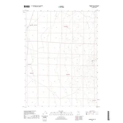
2018 Map of Sombrero Peak
USGS Topo · Published 2018About this map
Sombrero Peak rises at the southeastern corner of this map, overlooking the desert floor in Nevada's Humboldt County. This 2018 survey by the U.S. Geological Survey shows a landscape defined by dramatic geological formations, including the Slumbering Hills and isolated volcanic features like Gabica Butte and Corbeal Butte. The terrain is characterized by broad basins punctuated by these distinct uplands, with the Public Land Survey System grid overlaying sections within t39n r34e, t39n r35e, t38n r34e, and t38n r35e. Human infrastructure is sparse in this portion of the Great Basin, primarily limited to the passage of Sod House Rd along the western edge, suggesting a remote region used for grazing or mineral exploration rather than dense settlement.
Find a feature on this map
9 named features on this map. Tap any name to fly to it.
Don’t see what you’re looking for? This feature index may not catch every label — zoom into the map to look around manually.
Map Details
Editions of this 2018 Sombrero Peak Map
This is the sole edition of this map. No revisions or reprints were ever made.
Other maps of this area

1882 · Paradise
USGS Topo · 1:250,000

1886 · Disaster
USGS Topo · 1:250,000

1893 · Paradise
USGS Topo · 1:250,000

1893 · Disaster
USGS Topo · 1:250,000

1954 · Vya
USGS Topo · 1:250,000

1955 · McDermitt
USGS Topo · 1:250,000

1958 · Vya
USGS Topo · 1:250,000

1958 · Awakening Peak
USGS Topo · 1:62,500

1959 · McDermitt
USGS Topo · 1:250,000

1962 · Vya
USGS Topo · 1:250,000