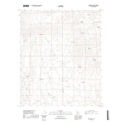
2018 Map of Sombrero Peak
USGS Topo · Published 2018About this map
Sombrero Peak rises above the high desert floor of eastern San Diego County, surrounded by the granite outcrops of the Tierra Blanca Mountains and the In-Ko-Pah Mountains. This landscape is defined by its deep canyons and upland valleys, including Thing Valley and Lost Valley, which have historically served as vital corridors through the arid terrain. The presence of the Manzanita Cem near Canebrake suggests the enduring cultural footprint of the region's indigenous communities along the Tecate Divide. Seasonal watercourses like Canebrake Wash and the Tule Cr carve paths through Simmons Canyon and Rockhouse Canyon, reflecting a drainage system that dictates the placement of backcountry routes such as McCain Valley Rd and Old Mine Rd. The map detail traces the intersection of these ancient pathways with modern access roads, providing a view of the transition from the high desert valleys into the rugged mountain ranges.
Find a feature on this map
31 named features on this map. Tap any name to fly to it.
Don’t see what you’re looking for? This feature index may not catch every label — zoom into the map to look around manually.
Map Details
Editions of this 2018 Sombrero Peak Map
This is the sole edition of this map. No revisions or reprints were ever made.
Other maps of this area

1931 · Carrizo
USGS Topo · 1:125,000

1939 · Campo
USGS Topo · 1:62,500

1939 · Jacumba
USGS Topo · 1:62,500

1942 · Campo
USGS Topo · 1:62,500

1942 · Carrizo Mtn
USGS Topo · 1:62,500

1942 · Jacumba
USGS Topo · 1:62,500

1942 · Cuyapaipe
USGS Topo · 1:62,500

1950 · San Diego
USGS Topo · 1:250,000

1954 · San Diego
USGS Topo · 1:250,000

1955 · San Diego
USGS Topo · 1:250,000