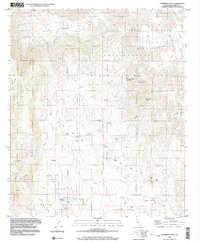
1997 Map of Sombrero Peak
USGS Topo · Published 2003About this map
Anza-Borrego Desert State Park encompasses a significant portion of this high-desert landscape, where the Tierra Blanca Mountains and Manzanita Mountains converge. The topography is defined by sharp elevation shifts across the Tecate Divide, with numerous springs providing vital water sources throughout the arid canyons. Notable palm groves, such as Sombrero Peak Palm Grove and Bow Willow Palms, mark the locations of these springs, offering a distinct contrast to the surrounding terrain.
Find a feature on this map
38 named features on this map. Tap any name to fly to it.
Don’t see what you’re looking for? This feature index may not catch every label — zoom into the map to look around manually.
Map Details
Editions of this 1997 Sombrero Peak Map
This is the sole edition of this map. No revisions or reprints were ever made.
Other maps of this area

1931 · Carrizo
USGS Topo · 1:125,000

1939 · Campo
USGS Topo · 1:62,500

1939 · Jacumba
USGS Topo · 1:62,500

1942 · Campo
USGS Topo · 1:62,500

1942 · Carrizo Mtn
USGS Topo · 1:62,500

1942 · Jacumba
USGS Topo · 1:62,500

1942 · Cuyapaipe
USGS Topo · 1:62,500

1950 · San Diego
USGS Topo · 1:250,000

1954 · San Diego
USGS Topo · 1:250,000

1955 · San Diego
USGS Topo · 1:250,000