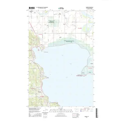
2017 Map of Somers
USGS Topo · Published 2017About this map
Flathead Lake dominates this 2017 survey, defining the geography of the northern shoreline where the Flathead River enters the valley. The map documents the residential and recreational development around Kalispell Bay and Peaceful Bay, with communities like Somers, Lakeside, and Bigfork serving as anchors for the local landscape. The presence of several private airstrips, including Sanders Airport and the Flathead Lake Sky Ranch Airport, speaks to the region's aviation-linked land use and accessibility.
Find a feature on this map
84 named features on this map. Tap any name to fly to it.
Don’t see what you’re looking for? This feature index may not catch every label — zoom into the map to look around manually.
Map Details
Editions of this 2017 Somers Map
This is the sole edition of this map. No revisions or reprints were ever made.
Other maps of this area

1920 · Flathead Lake
USGS Topo · 1:125,000

1943 · Kalispell
USGS Topo · 1:125,000

1956 · Wallace
USGS Topo · 1:250,000

1957 · Kalispell
USGS Topo · 1:250,000

1960 · Kalispell
USGS Topo · 1:250,000

1960 · Wallace
USGS Topo · 1:250,000

1961 · Kalispell
USGS Topo · 1:250,000

1962 · Lion Mountain
USGS Topo · 1:24,000

1962 · Somers
USGS Topo · 1:24,000

1962 · Creston
USGS Topo · 1:24,000