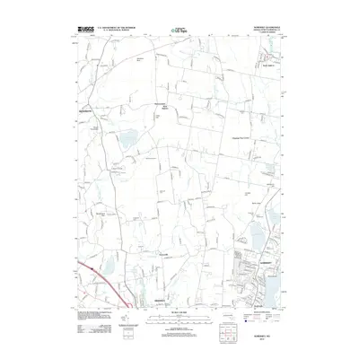
2012 Map of Somerset
USGS Topo · Published 2012About this map
The Taunton River and its intricate network of tributaries define the landscape of Bristol County on this 2012 survey. Centered on the town of Somerset, the map reveals a suburban and rural mosaic where old village centers like Hortonville and West Dighton remain distinct from later development. Historic landmarks such as Annawan Rock and Mount Terrydiddle persist alongside a concentration of burial sites including Saint Patricks Cem and the Eddy Cem. The abundance of water features, from the Cole River to the Somerset Reservoir, illustrates the vital role of local hydrology in shaping land use. Along the eastern edge, the waterfront at Pottersville and Pierce Beach shows the community's orientation toward the river, while inland, areas like Manwhague Plain and Bettencourt Farms suggest a transition into more open, agricultural terrain.
Find a feature on this map
139 named features on this map. Tap any name to fly to it.
Don’t see what you’re looking for? This feature index may not catch every label — zoom into the map to look around manually.
Map Details
Editions of this 2012 Somerset Map
This is the sole edition of this map. No revisions or reprints were ever made.
Other maps of this area

1885 · Taunton
USGS Topo · 1:62,500

1887 · Providence
USGS Topo · 1:62,500

1888 · Fall River
USGS Topo · 1:62,500

1888 · Taunton
USGS Topo · 1:62,500

1889 · Providence
USGS Topo · 1:62,500

1890 · Narragansett Bay
USGS Topo · 1:62,500

1892 · Narragansett Bay
USGS Topo · 1:62,500

1893 · Taunton
USGS Topo · 1:62,500

1893 · Fall River
USGS Topo · 1:62,500

1894 · Providence
USGS Topo · 1:62,500