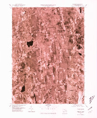
1977 Map of Somerset
USGS Topo · Published 1981About this map
The Taunton River serves as the eastern boundary for the town of Somerset in this 1977 orthophotograph, which uses aerial imagery to document the suburban and rural landscapes of Bristol County. This aerial perspective reveals the dense residential patterns of the town center contrasted with the winding waterways that define the region's geography. To the north, the confluence of the Threemile River and the larger estuary provides a clear view of the historical industrial footprint near North Dighton. Moving inland, the terrain transitions into the more dispersed settlements of Hortonville and Perrys Corner, where the Cole River and Segreganset River carve through the wooded Massachusetts interior. This orthophoto quadrangle is particularly useful for researchers studying 1970s land use and the specific boundaries of late-century development in Rehoboth and Dighton.
Find a feature on this map
11 named features on this map. Tap any name to fly to it.
Don’t see what you’re looking for? This feature index may not catch every label — zoom into the map to look around manually.
Map Details
Editions of this 1977 Somerset Map
This is the sole edition of this map. No revisions or reprints were ever made.
Other maps of this area

1885 · Taunton
USGS Topo · 1:62,500

1887 · Providence
USGS Topo · 1:62,500

1888 · Fall River
USGS Topo · 1:62,500

1888 · Taunton
USGS Topo · 1:62,500

1889 · Providence
USGS Topo · 1:62,500

1890 · Narragansett Bay
USGS Topo · 1:62,500

1892 · Narragansett Bay
USGS Topo · 1:62,500

1893 · Taunton
USGS Topo · 1:62,500

1893 · Fall River
USGS Topo · 1:62,500

1894 · Providence
USGS Topo · 1:62,500