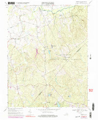
1966 Map of Somerville
USGS Topo · Published 1991About this map
Somerville and the surrounding rural landscape of Fauquier and Prince William Counties are shown here during a mid-century period of stability, prior to later suburban expansion. The terrain is defined by a dense network of small waterways, including Cedar Run, Town Run, and Aquia Creek, which dictate the placement of early settlements and roads. A significant portion of the eastern landscape is occupied by the Quantico Marine Corps Schools, illustrating the historical intersection of military land use and Virginia's agricultural heritage.
Find a feature on this map
45 named features on this map. Tap any name to fly to it.
Don’t see what you’re looking for? This feature index may not catch every label — zoom into the map to look around manually.
Map Details
Editions of this 1966 Somerville Map
4 editions found
Other maps of this area

1887 · Spottsylvania
USGS Topo · 1:125,000

1889 · Fredericksburg
USGS Topo · 1:125,000

1890 · Mt. Vernon
USGS Topo · 1:125,000

1891 · Mt. Vernon
USGS Topo · 1:125,000

1892 · Fredericksburg
USGS Topo · 1:125,000

1892 · Spottsylvania
USGS Topo · 1:125,000

1894 · Warrenton
USGS Topo · 1:125,000

1894 · Fredericksburg
USGS Topo · 1:125,000

1894 · Mt. Vernon
USGS Topo · 1:125,000

1897 · Mt. Vernon
USGS Topo · 1:125,000