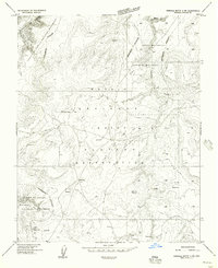
1955 Map of Sonsala Butte 4 SW
USGS Topo · Published 1958About this map
Defiance Plateau high country defines this 1950s survey of the high desert, where the northern reaches of the Navajo Indian Reservation meet the dramatic geological boundaries of Canyon De Chelly National Monument. The settlement of White Clay stands as the primary human landmark amidst a landscape of seasonal drainage systems like Coyote Wash and Whiskey Creek. This era of the plateau is characterized by a reliance on scattered water resources, evidenced by the numerous reservoirs, springs, and an isolated Windmill dotting the terrain. The map captures the complex topography of the Canyon De Chelly area before modern infrastructure expanded, showing a network of unimproved trails and early roads that connected remote homesteads and grazing lands across the Apache County highlands.
Find a feature on this map
13 named features on this map. Tap any name to fly to it.
Don’t see what you’re looking for? This feature index may not catch every label — zoom into the map to look around manually.
Map Details
Editions of this 1955 Sonsala Butte 4 SW Map
This is the sole edition of this map. No revisions or reprints were ever made.
Other maps of this area

1886 · Fort Defiance
USGS Topo · 1:250,000

1892 · Fort Defiance
USGS Topo · 1:250,000

1892 · Canyon De Chelly
USGS Topo · 1:250,000

1954 · Shiprock
USGS Topo · 1:250,000

1954 · Gallup
USGS Topo · 1:250,000

1955 · Zith-Tusayan Butte 2 NE
USGS Topo · 1:24,000

1955 · Sonsala Butte 4 SE
USGS Topo · 1:24,000

1955 · Sonsala Butte 4 NW
USGS Topo · 1:24,000

1955 · Sonsala Butte 3 SE
USGS Topo · 1:24,000
1955 · Zith-Tusayan Butte 1 NE
USGS Topo · 1:24,000