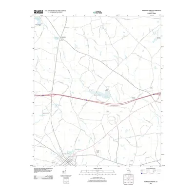
2011 Map of Soperton North
USGS Topo · Published 2011About this map
Soperton anchors the southern edge of this Treutlen County landscape, where the municipal limits reach toward the Treutlen County Airport and Sherrod Pond. The region is defined by its agricultural and cemetery clusters, indicating long-standing family settlements such as Blackville and Zaidee. Significant water management is evident through numerous private impoundments including Anderson Pond Dam and Sumners Pond Dam, which feed into the wandering course of Pendleton Creek. Genealogists will find a high density of small burial grounds across the area, from Ricks Cemetery in the north to Hutchinson Cemetery and Gillis Cemetery near the county line. The map captures the infrastructure of this rural community, connecting isolated farms and homesteads via an extensive network of county roads like County Rd-64 and County Rd-5.
Find a feature on this map
76 named features on this map. Tap any name to fly to it.
Don’t see what you’re looking for? This feature index may not catch every label — zoom into the map to look around manually.
Map Details
Editions of this 2011 Soperton North Map
This is the sole edition of this map. No revisions or reprints were ever made.
Other maps of this area

1957 · Macon
USGS Topo · 1:250,000

1958 · Macon
USGS Topo · 1:250,000

1964 · Macon
USGS Topo · 1:250,000

1970 · Oak Park SW
USGS Topo · 1:24,000

1970 · Covena
USGS Topo · 1:24,000

1971 · Norristown
USGS Topo · 1:24,000

1971 · Soperton South
USGS Topo · 1:24,000

1971 · Soperton North
USGS Topo · 1:24,000

1971 · Lothair
USGS Topo · 1:24,000

1971 · Rockledge
USGS Topo · 1:24,000