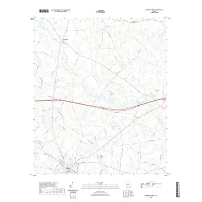
2020 Map of Soperton North
USGS Topo · Published 2020About this map
Soperton anchors the southern edge of this Central Georgia landscape, where the Treutlen County Courthouse stands as a local civic landmark. To the north, the small settlement of Blackville sits near the crossing of several county routes, illustrating the rural development patterns of the region. The terrain is defined by a dense network of waterways, most notably Pendleton Cr and its various tributaries like Alligator Cr and Tiger Cr. These streams feed into numerous ponds and small lakes, including Sherrod Pond, Gillis Pond, and Sand Hill Lake. For family historians, the map is a significant resource for identifying old burial grounds scattered across the countryside, such as Ricks Cem, Hutchinson Cem, and Zaidee Cem. The presence of the Treutlen County Airport further highlights the modern transportation infrastructure overlaying this traditionally agricultural and creek-bottom landscape.
Find a feature on this map
93 named features on this map. Tap any name to fly to it.
Don’t see what you’re looking for? This feature index may not catch every label — zoom into the map to look around manually.
Map Details
Editions of this 2020 Soperton North Map
This is the sole edition of this map. No revisions or reprints were ever made.
Other maps of this area

1957 · Macon
USGS Topo · 1:250,000

1958 · Macon
USGS Topo · 1:250,000

1964 · Macon
USGS Topo · 1:250,000

1970 · Oak Park SW
USGS Topo · 1:24,000

1970 · Covena
USGS Topo · 1:24,000

1971 · Norristown
USGS Topo · 1:24,000

1971 · Soperton South
USGS Topo · 1:24,000

1971 · Soperton North
USGS Topo · 1:24,000

1971 · Lothair
USGS Topo · 1:24,000

1971 · Rockledge
USGS Topo · 1:24,000