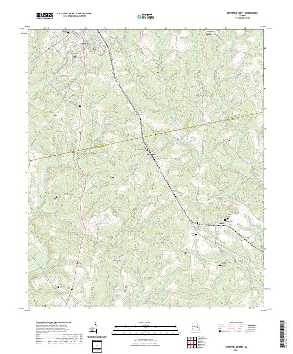
2024 Map of Soperton South
USGS Topo · Published 2024About this map
The boundary between Treutlen and Montgomery counties bisects this rural landscape, defined by a network of creeks and numerous family cemeteries. The town of Tarrytown sits at a crossroads in the center, while Kibbee serves as a small hub to the southeast near the banks of Shotbag Creek. This region is characterized by its agricultural character and extensive hydrography, with larger water bodies like Coleman Lake and Hamilton Lake punctuating the terrain.
Find a feature on this map
116 named features on this map. Tap any name to fly to it.
Don’t see what you’re looking for? This feature index may not catch every label — zoom into the map to look around manually.
Map Details
Editions of this 2024 Soperton South Map
This is the sole edition of this map. No revisions or reprints were ever made.
Other maps of this area

1957 · Macon
USGS Topo · 1:250,000

1958 · Macon
USGS Topo · 1:250,000

1964 · Macon
USGS Topo · 1:250,000

1970 · Glenwood
USGS Topo · 1:24,000

1970 · Oak Park SW
USGS Topo · 1:24,000

1970 · Covena
USGS Topo · 1:24,000

1970 · Mount Vernon
USGS Topo · 1:24,000

1970 · Vidalia
USGS Topo · 1:24,000

1971 · Soperton South
USGS Topo · 1:24,000

1971 · Soperton North
USGS Topo · 1:24,000