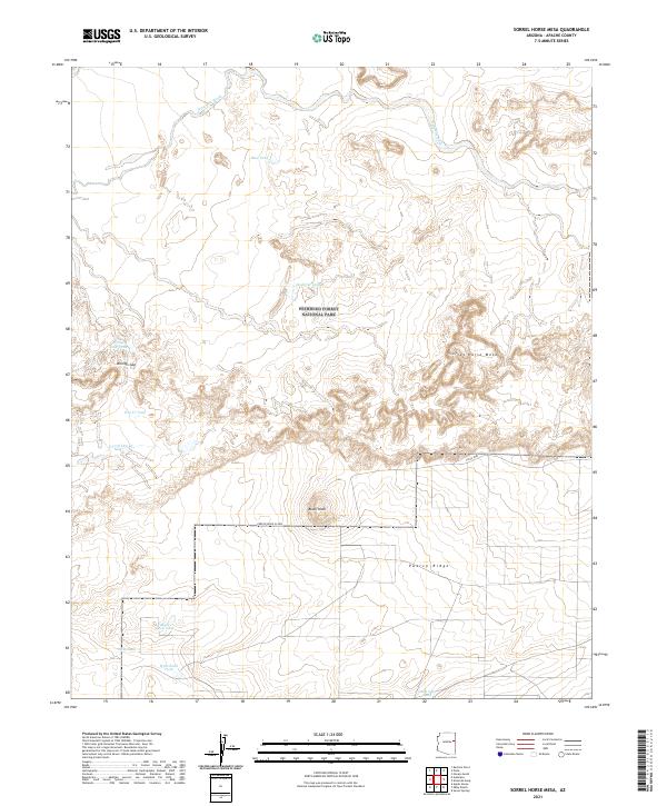
2021 Map of Sorrel Horse Mesa
USGS Topo · Published 2021About this map
Petrified Forest National Park spans the central portion of this Apache County landscape, preserving a high-desert environment defined by dramatic geological formations and seasonal drainages. The terrain is characterized by prominent elevations such as Sorrel Horse Mesa and the expansive Puerco Ridge, while drainage is provided by Ninemile Wash in the north and E Fork Dry Cr further south.
Find a feature on this map
26 named features on this map. Tap any name to fly to it.
Don’t see what you’re looking for? This feature index may not catch every label — zoom into the map to look around manually.
Map Details
Editions of this 2021 Sorrel Horse Mesa Map
This is the sole edition of this map. No revisions or reprints were ever made.
Other maps of this area

1886 · St Johns
USGS Topo · 1:250,000

1886 · Fort Defiance
USGS Topo · 1:250,000

1892 · Fort Defiance
USGS Topo · 1:250,000

1892 · St Johns
USGS Topo · 1:250,000

1912 · Petrified Forest
USGS Topo · 1:62,500

1954 · Saint Johns
USGS Topo · 1:250,000

1954 · Gallup
USGS Topo · 1:250,000

1955 · Petrified Forest
USGS Topo · 1:62,500

1955 · Adamana 1 SW
USGS Topo · 1:24,000

1956 · Adamana 1 NW
USGS Topo · 1:24,000