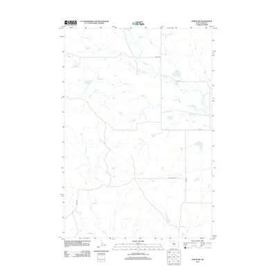
2012 Map of Sorum SW
USGS Topo · Published 2012About this map
Antelope Cr winds across this prairie landscape in southern Harding County, where the topography is defined by the ephemeral drainage systems of the northern Great Plains. The map captures a rural network of section-line roads and family-named routes, including Vernal Rd and Wells Rd, which serve the remote ranching properties of the region. Towards the southern portion of the sheet, Ash Cr and Sheep Cr provide the primary hydrologic features, cutting through the terrain alongside north-south connectors like Marty Rd and Zeona Rd. This 2012 survey illustrates the enduring agricultural and ranching layout of the area, where water sources like Antelope Cr remain the focal points for land use and habitation in a sparsely populated corner of South Dakota.
Find a feature on this map
9 named features on this map. Tap any name to fly to it.
Don’t see what you’re looking for? This feature index may not catch every label — zoom into the map to look around manually.
Map Details
Editions of this 2012 Sorum SW Map
This is the sole edition of this map. No revisions or reprints were ever made.
Other maps of this area

1935 · Hoover
USGS Topo · 1:125,000

1954 · Lemmon
USGS Topo · 1:250,000

1957 · Lemmon
USGS Topo · 1:250,000

1968 · Sheep Mountain
USGS Topo · 1:24,000

1968 · Flat Top Butte
USGS Topo · 1:24,000
1978 · Fish Draw
USGS Topo · 1:24,000

1980 · Redig
USGS Topo · 1:100,000

1980 · Zeona
USGS Topo · 1:25,000

1983 · Sorum NE
USGS Topo · 1:24,000
1983 · Sorum
USGS Topo · 1:24,000