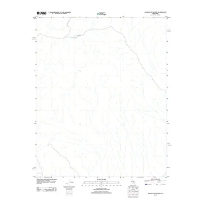
2012 Map of Sourdough Spring
USGS Topo · Published 2012About this map
Myers Ranch sits at a lonely intersection of water and transport in this corner of San Bernardino County. Located near the northern edge of the map, the ranch serves as a primary marker for human habitation in a landscape otherwise defined by drainage patterns and arid terrain. The nearby Sourdough Spring provides a critical natural water source that likely dictated the placement of the ranch and the path of the regional trails. Transport through this area is facilitated by Coyote Canyon Rd, which cuts across the northern topography. This 2012 survey illustrates the enduring relationship between scarce water resources and settlement patterns in the California desert, showing how isolated outposts like the ranch depend on the few reliable springs found in the surrounding canyons.
Find a feature on this map
4 named features on this map. Tap any name to fly to it.
Don’t see what you’re looking for? This feature index may not catch every label — zoom into the map to look around manually.
Map Details
Editions of this 2012 Sourdough Spring Map
This is the sole edition of this map. No revisions or reprints were ever made.
Other maps of this area

1915 · Searles Lake
USGS Topo · 1:250,000

1933 · Avawatz Mountains
USGS Topo · 1:250,000

1947 · Trona
USGS Topo · 1:250,000

1948 · Trona
USGS Topo · 1:250,000

1948 · Quail Mountains
USGS Topo · 1:62,500

1950 · Manly Peak
USGS Topo · 1:62,500

1950 · Wingate Wash
USGS Topo · 1:62,500

1950 · Wingate Pass
USGS Topo · 1:62,500

1951 · Wingate Pass
USGS Topo · 1:62,500

1951 · Quail Mountains
USGS Topo · 1:62,500