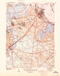
1941 Map of South Amboy
USGS Topo · Published 1941About this map
Industrial and maritime development along the Raritan River and Raritan Bay defines this landscape on the eve of World War II. The city of South Amboy serves as a major hub where the Pennsylvania RR and Raritan River RR converge amidst a dense network of railyards and docks. Near the mouth of the river, Ferry Pt and the Great Beds L H guide maritime traffic navigating the coastal waters of Middlesex and Monmouth counties.
Find a feature on this map
60 named features on this map. Tap any name to fly to it.
Don’t see what you’re looking for? This feature index may not catch every label — zoom into the map to look around manually.
Map Details
Editions of this 1941 South Amboy Map
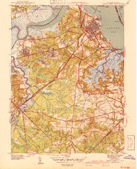
2 editions found
Other maps of this area

1888 · Plainfield
USGS Topo · 1:62,500

1888 · New Brunswick
USGS Topo · 1:62,500

1888 · Sandy Hook
USGS Topo · 1:62,500

1893 · New Brunswick
USGS Topo · 1:62,500

1893 · Plainfield
USGS Topo · 1:62,500

1893 · Sandy Hook
USGS Topo · 1:62,500

1898 · Plainfield
USGS Topo · 1:62,500

1898 · Staten Island
USGS Topo · 1:62,500

1900 · Passaic
USGS Topo · 1:125,000

1900 · Staten Island
USGS Topo · 1:62,500