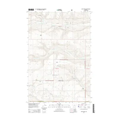
2014 Map of South Bench
USGS Topo · Published 2014About this map
Little Snowy Mountains foothills dominate this landscape in Fergus County, where high plateaus and deep drainages define the regional geography. The map documents the transition from the open grazing lands of South Bench and Middle Bench into the protected timber of the Lewis & Clark National Forest. Water sources are critical in this arid environment, marked by named points such as Ashbridge Spring, Posey Spring, and Cameron Creek Spr.
Find a feature on this map
33 named features on this map. Tap any name to fly to it.
Don’t see what you’re looking for? This feature index may not catch every label — zoom into the map to look around manually.
Map Details
Editions of this 2014 South Bench Map
This is the sole edition of this map. No revisions or reprints were ever made.
Other maps of this area

1889 · Big Snowy Mountain
USGS Topo · 1:250,000

1893 · Big Snowy Mountain
USGS Topo · 1:250,000

1954 · Roundup
USGS Topo · 1:250,000

1958 · Roundup
USGS Topo · 1:250,000

1970 · Forestgrove
USGS Topo · 1:24,000

1970 · South Bench
USGS Topo · 1:24,000
1970 · Alaska Bench
USGS Topo · 1:24,000
1970 · Loco Ridge
USGS Topo · 1:24,000

1986 · Devils Hole Lake
USGS Topo · 1:24,000

1986 · Patterson Canyon
USGS Topo · 1:24,000