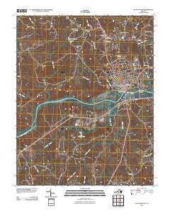
2010 Map of South Boston
USGS Topo · Published 2010About this map
The Dan River flows prominently through the southern reaches of South Boston, serving as a central geographic anchor for this 2010 topographic record. Connectivity across this waterway is facilitated by the Tucker C Watkins Memorial Bridges and the Randolph Bridge, linking the core of town with southern areas like Riverdale. The landscape is a mix of established residential developments such as Woodlawn Park and Highland Hills, and more specialized landmarks including Loves Shop. Numerous small dams, such as McGaulin and Mays Dam and Williams Dam, indicate a history of local water management across the various creeks. Genealogists and historians will find a high density of burial sites documented here, including Oak Ridge Cemetery, Halifax Memorial Gardens, and the Dan River Cemetery.
Find a feature on this map
40 named features on this map. Tap any name to fly to it.
Don’t see what you’re looking for? This feature index may not catch every label — zoom into the map to look around manually.
Map Details
Editions of this 2010 South Boston Map
This is the sole edition of this map. No revisions or reprints were ever made.
Other maps of this area

1952 · Milton
USGS Topo · 1:62,500

1953 · South Boston
USGS Topo · 1:62,500

1953 · Greensboro
USGS Topo · 1:250,000

1954 · Greensboro
USGS Topo · 1:250,000

1954 · Halifax
USGS Topo · 1:62,500

1954 · Riceville
USGS Topo · 1:62,500

1956 · Milton
USGS Topo · 1:62,500

1957 · South Boston
USGS Topo · 1:62,500

1962 · Greensboro
USGS Topo · 1:250,000

1966 · Greensboro
USGS Topo · 1:250,000