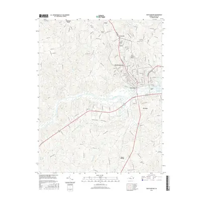
2016 Map of South Boston
USGS Topo · Published 2016About this map
South Boston serves as the focal point of this Halifax County landscape, where the Dan River snakes through the center of the terrain. The community of Riverdale sits just south of the riverbanks, connected to the main town by the Tucker C Watkins Memorial Bridge and the Randolph Bridge. This area exhibits a dense concentration of local heritage sites, including Oak Ridge Cem and Halifax Memorial Gardens, alongside several outlying burial grounds like Cherry Hill Cem and Pleasant Grove Cem. To the north, the county seat of Halifax and the settlement of Centerville define the upper corridor, while the southern reaches transition into the rolling topography of Cluster Springs. The presence of the John H Kerr Reservoir in the east and numerous creek systems like Lawsons Cr and Stokes Cr illustrates the well-watered nature of this Virginia Piedmont region.
Find a feature on this map
144 named features on this map. Tap any name to fly to it.
Don’t see what you’re looking for? This feature index may not catch every label — zoom into the map to look around manually.
Map Details
Editions of this 2016 South Boston Map
This is the sole edition of this map. No revisions or reprints were ever made.
Other maps of this area

1952 · Milton
USGS Topo · 1:62,500

1953 · South Boston
USGS Topo · 1:62,500

1953 · Greensboro
USGS Topo · 1:250,000

1954 · Greensboro
USGS Topo · 1:250,000

1954 · Halifax
USGS Topo · 1:62,500

1954 · Riceville
USGS Topo · 1:62,500

1956 · Milton
USGS Topo · 1:62,500

1957 · South Boston
USGS Topo · 1:62,500

1962 · Greensboro
USGS Topo · 1:250,000

1966 · Greensboro
USGS Topo · 1:250,000