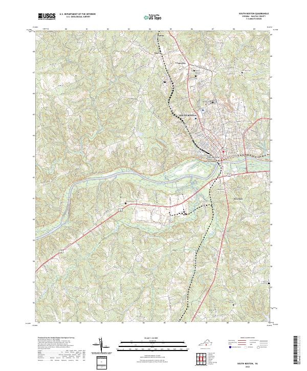
2022 Map of South Boston
USGS Topo · Published 2022About this map
The Dan River winds through this section of Halifax County, anchoring the commercial and educational center of South Boston. The map documents a landscape where traditional southern Virginia settlements like Sinai and Centerville meet modern regional infrastructure, including the Southside Virginia Community College. A significant concentration of local heritage sites is visible, from the established Oak Ridge Cem near the town center to the Peaceful Tabernacle Cem and Halifax Memorial Gardens further north.
Find a feature on this map
150 named features on this map. Tap any name to fly to it.
Don’t see what you’re looking for? This feature index may not catch every label — zoom into the map to look around manually.
Map Details
Editions of this 2022 South Boston Map
This is the sole edition of this map. No revisions or reprints were ever made.
Other maps of this area

1952 · Milton
USGS Topo · 1:62,500

1953 · South Boston
USGS Topo · 1:62,500

1953 · Greensboro
USGS Topo · 1:250,000

1954 · Greensboro
USGS Topo · 1:250,000

1954 · Halifax
USGS Topo · 1:62,500

1954 · Riceville
USGS Topo · 1:62,500

1956 · Milton
USGS Topo · 1:62,500

1957 · South Boston
USGS Topo · 1:62,500

1962 · Greensboro
USGS Topo · 1:250,000

1966 · Greensboro
USGS Topo · 1:250,000