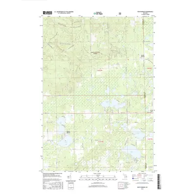
2017 Map of South Branch
USGS Topo · Published 2017About this map
Huron National Forest dominates the northern landscape of this region, where the Mack - Maltby Hills Loop Trail and Lupton Smt DNR643 wind through the hills west of South Branch. The settlement pattern is defined by its proximity to water, with concentrations of dwellings at Shady Shores and around the extensive shores of Au Sable Lake. This 2017 survey reveals a complex network of glacial lakes and wetlands, including Maltby Swamp and the headwaters of Mink Cr. Local history is anchored by the Oak Grove Cem and Hill Township Cem, providing essential landmarks for genealogical research. The map tracks the boundary between Ogemaw and Iosco counties, showing how modern roads like Co Hwy F-26 and Co RD 22 connect these lakeside communities.
Find a feature on this map
89 named features on this map. Tap any name to fly to it.
Don’t see what you’re looking for? This feature index may not catch every label — zoom into the map to look around manually.
Map Details
Editions of this 2017 South Branch Map
This is the sole edition of this map. No revisions or reprints were ever made.
Other maps of this area

1954 · Traverse City
USGS Topo · 1:250,000

1954 · Tawas City
USGS Topo · 1:250,000

1958 · Traverse City
USGS Topo · 1:250,000

1958 · Tawas City
USGS Topo · 1:250,000

1965 · Selkirk
USGS Topo · 1:24,000

1965 · Rose City
USGS Topo · 1:24,000

1968 · Hale
USGS Topo · 1:24,000

1968 · Sage Lake
USGS Topo · 1:24,000

1968 · South Branch
USGS Topo · 1:24,000

1968 · Hale SE
USGS Topo · 1:24,000