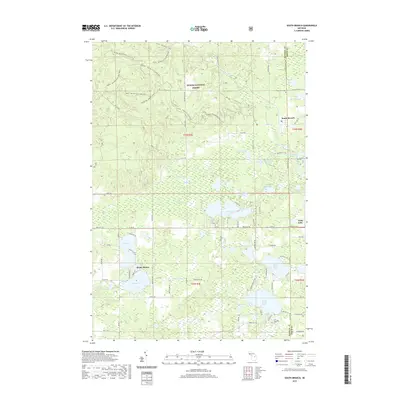
2019 Map of South Branch
USGS Topo · Published 2019About this map
Huron National Forest dominates the northern reaches of this Ogemaw County terrain, where the undulating Maltby Hills are carved by an extensive network of recreational trails. These routes, including the Mack - Old Baldy Trail and the Mack - Maltby Hills Loop Trail, illustrate the modern use of this heavily forested landscape. The southern half of the map shifts toward a dense cluster of glacial lakes and small residential pockets. Settlements like Shady Shores and Long Lake line the waterfronts, while South Branch serves as a small crossroad hub near the eastern boundary. The presence of the Hill Township Cem and Oak Grove Cem provides specific points of interest for genealogists tracing local families in this part of Michigan. The intricate drainage of Au Sable Cr and the complex of wetlands including Maltbys Swamp define the transition between the high hills and the lake-studded plains.
Find a feature on this map
92 named features on this map. Tap any name to fly to it.
Don’t see what you’re looking for? This feature index may not catch every label — zoom into the map to look around manually.
Map Details
Editions of this 2019 South Branch Map
This is the sole edition of this map. No revisions or reprints were ever made.
Other maps of this area

1954 · Traverse City
USGS Topo · 1:250,000

1954 · Tawas City
USGS Topo · 1:250,000

1958 · Traverse City
USGS Topo · 1:250,000

1958 · Tawas City
USGS Topo · 1:250,000

1965 · Selkirk
USGS Topo · 1:24,000

1965 · Rose City
USGS Topo · 1:24,000

1968 · Hale
USGS Topo · 1:24,000

1968 · Sage Lake
USGS Topo · 1:24,000

1968 · South Branch
USGS Topo · 1:24,000

1968 · Hale SE
USGS Topo · 1:24,000