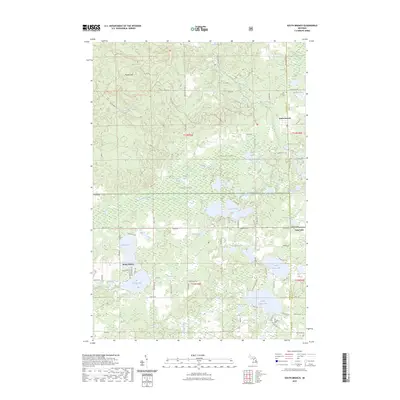
2023 Map of South Branch
USGS Topo · Published 2023About this map
Huron National Forest dominates this section of the Michigan landscape, where the South Branch River and Au Sable Creek weave through a dense network of glacial lakes. The terrain is defined by the Maltby Hills to the northwest and expansive wetlands like Maltbys Swamp, reflecting the region’s glacial geology. Small lakefront communities such as Shady Shores and Long Lake cluster around water bodies like George Lake and North Dease Lake, showing the transition from forest wilderness to seasonal and residential settlement. Genealogists will find the Oak Grove Cem near South Branch and the Hill Township Cem to the south, both serving as anchors for local family history in this heavily forested area. Extensive trail systems, including the Mack-South Branch Loop Trl, highlight the area's modern identity as a hub for outdoor recreation within the national forest boundaries.
Find a feature on this map
74 named features on this map. Tap any name to fly to it.
Don’t see what you’re looking for? This feature index may not catch every label — zoom into the map to look around manually.
Map Details
Editions of this 2023 South Branch Map
This is the sole edition of this map. No revisions or reprints were ever made.
Other maps of this area

1954 · Traverse City
USGS Topo · 1:250,000

1954 · Tawas City
USGS Topo · 1:250,000

1958 · Traverse City
USGS Topo · 1:250,000

1958 · Tawas City
USGS Topo · 1:250,000

1965 · Selkirk
USGS Topo · 1:24,000

1965 · Rose City
USGS Topo · 1:24,000

1968 · Hale
USGS Topo · 1:24,000

1968 · Sage Lake
USGS Topo · 1:24,000

1968 · South Branch
USGS Topo · 1:24,000

1968 · Hale SE
USGS Topo · 1:24,000