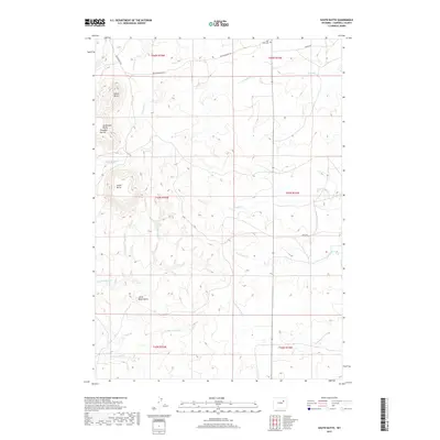
2017 Map of South Butte
USGS Topo · Published 2017About this map
The high plains of Campbell County are dominated by a series of prominent rises including South Mid Butte Pumpkin Buttes, South Butte, and Indian Butte. This 2017 survey details the headwaters of the Belle Fourche River, which begins its course across the southern portion of the quadrangle. The map reveals an intricate network of ephemeral drainages with evocative names such as All Night Cr and its tributary, S All Night Cr, alongside Dry Willow Cr and Fourmile Cr. For genealogists and local historians, the Four Mile Cem serves as a significant landmark in the northern reaches, positioned near Van Buggenum Rd. The landscape is largely defined by open rangeland and the topographical isolation of features like Little Black Butte, connected by rural routes like Christenson Rd and Todo Rd.
Find a feature on this map
22 named features on this map. Tap any name to fly to it.
Don’t see what you’re looking for? This feature index may not catch every label — zoom into the map to look around manually.
Map Details
Editions of this 2017 South Butte Map
This is the sole edition of this map. No revisions or reprints were ever made.
Other maps of this area

1953 · Savageton
USGS Topo · 1:24,000

1953 · South Butte
USGS Topo · 1:24,000

1953 · Rolling Pin Ranch
USGS Topo · 1:24,000

1953 · North Butte
USGS Topo · 1:24,000

1954 · Artesian Draw
USGS Topo · 1:24,000

1954 · Pine Tree
USGS Topo · 1:24,000

1955 · Newcastle
USGS Topo · 1:250,000

1958 · Newcastle
USGS Topo · 1:250,000

1959 · Savageton
USGS Topo · 1:62,500

1959 · North Star School
USGS Topo · 1:62,500