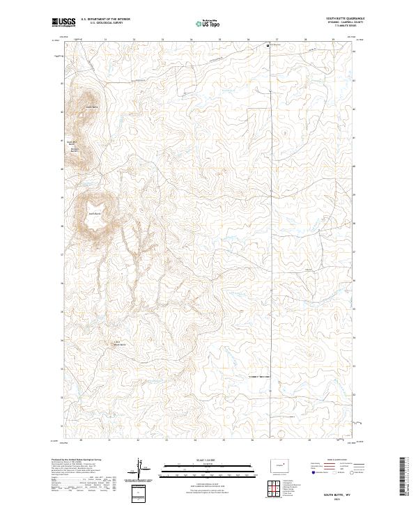
2021 Map of South Butte
USGS Topo · Published 2021About this map
Pumpkin Buttes rise above the high plains of Campbell County, serving as the dominant topographical landmarks in this part of northeastern Wyoming. The quadrangle is defined by these dramatic landforms, including South Butte, Indian Butte, and South Mid Butte, which overlook a network of intermittent drainages like Fourmile Cr and All Night Cr. These waterways eventually feed into the Belle Fourche River, which cuts across the southeastern portion of the map.
Find a feature on this map
23 named features on this map. Tap any name to fly to it.
Don’t see what you’re looking for? This feature index may not catch every label — zoom into the map to look around manually.
Map Details
Editions of this 2021 South Butte Map
This is the sole edition of this map. No revisions or reprints were ever made.
Other maps of this area

1953 · Savageton
USGS Topo · 1:24,000

1953 · South Butte
USGS Topo · 1:24,000

1953 · Rolling Pin Ranch
USGS Topo · 1:24,000

1953 · North Butte
USGS Topo · 1:24,000

1954 · Artesian Draw
USGS Topo · 1:24,000

1954 · Pine Tree
USGS Topo · 1:24,000

1955 · Newcastle
USGS Topo · 1:250,000

1958 · Newcastle
USGS Topo · 1:250,000

1959 · Savageton
USGS Topo · 1:62,500

1959 · North Star School
USGS Topo · 1:62,500