
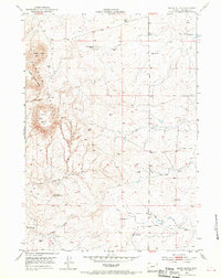
1953 Map of South Butte
USGS Topo · Published 1954About this map
The Pumpkin Buttes dominate this Campbell County landscape, reflecting a time when the Atomic Energy Commission took a keen interest in the region's geological potential. These prominent landmarks, including Indian Butte, Middle Butte, and the primary South Butte, served as essential navigational markers for ranchers and early settlers. The settlement pattern here is defined by isolated family operations, such as Hardin Ranch and Ruby Ranch, linked by a network of unimproved dirt roads that follow the drainage basins of the Belle Fourche River and All Night Creek.
Find a feature on this map
21 named features on this map. Tap any name to fly to it.
Don’t see what you’re looking for? This feature index may not catch every label — zoom into the map to look around manually.
Map Details
Editions of this 1953 South Butte Map
3 editions found
Other maps of this area

1953 · Savageton
USGS Topo · 1:24,000

1953 · Rolling Pin Ranch
USGS Topo · 1:24,000

1953 · North Butte
USGS Topo · 1:24,000

1954 · Artesian Draw
USGS Topo · 1:24,000

1954 · Pine Tree
USGS Topo · 1:24,000

1955 · Newcastle
USGS Topo · 1:250,000

1958 · Newcastle
USGS Topo · 1:250,000

1959 · Savageton
USGS Topo · 1:62,500

1959 · North Star School
USGS Topo · 1:62,500

1960 · Turnercrest
USGS Topo · 1:62,500