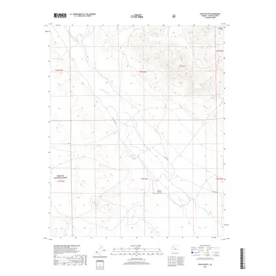
2018 Map of South Butte
USGS Topo · Published 2018About this map
South Butte rises as a prominent landmark in this high-desert portion of Yavapai County, situated at the intersection of significant drainage systems and early transportation corridors. The arid landscape is defined by the broad Big Chino Wash, which is flanked by the elevated Big Black Mesa to the northeast. Human presence in this section of the Prescott National Forest is marked by a network of rural routes, including Big Chino Rd and Big Chino Wash Rd, which facilitate access through the difficult terrain. A notable feature for local history and aviation researchers is the Big Chino Airstrip, situated on the flatlands near the junction of several seasonal watercourses such as Pine Cr and Partridge Cr. The map captures a landscape largely defined by public land boundaries and the natural hydrology of the Chino Valley region.
Find a feature on this map
15 named features on this map. Tap any name to fly to it.
Don’t see what you’re looking for? This feature index may not catch every label — zoom into the map to look around manually.
Map Details
Editions of this 2018 South Butte Map
This is the sole edition of this map. No revisions or reprints were ever made.
Other maps of this area

1886 · Chino
USGS Topo · 1:250,000

1887 · Prescott
USGS Topo · 1:250,000

1891 · Chino
USGS Topo · 1:250,000

1892 · Prescott
USGS Topo · 1:250,000

1947 · Simmons
USGS Topo · 1:62,500

1947 · Picacho Butte
USGS Topo · 1:62,500

1947 · Turkey Canyon
USGS Topo · 1:62,500

1947 · Camp Wood
USGS Topo · 1:62,500

1948 · Williams
USGS Topo · 1:250,000

1948 · Picacho Butte
USGS Topo · 1:63,360