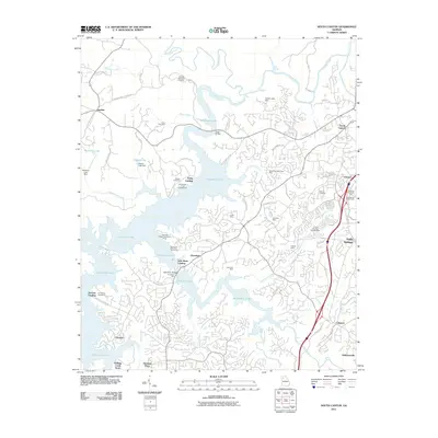
2011 Map of South Canton
USGS Topo · Published 2011About this map
The sprawling waters of Allatoona Lake dominate the landscape north of Woodstock, Georgia, where the Etowah River and Little River converge. This area reflects a deep history of resource extraction, evidenced by a dense cluster of gold-era mining sites including the Sixes Mine, Downing Creek Placer Mine, and the Putnam Mine east of the reservoir. The topography is shaped by both modern recreation and solemn commemoration, with the Georgia National Cemetery overlooking the northern banks while the Noonday Baptist Association Camp and various landings like Fields Landing dot the shoreline. Transportation corridors like the Interstate 575 bypass the older settlements of Holly Springs and Lebanon, while family-named landmarks such as Cherokee Mill and the Knox Bridge link the modern reservoir back to its earlier industrial and agricultural roots.
Find a feature on this map
80 named features on this map. Tap any name to fly to it.
Don’t see what you’re looking for? This feature index may not catch every label — zoom into the map to look around manually.
Map Details
Editions of this 2011 South Canton Map
This is the sole edition of this map. No revisions or reprints were ever made.
Other maps of this area

1890 · Suwanee
USGS Topo · 1:125,000

1890 · Cartersville
USGS Topo · 1:125,000

1891 · Cartersville
USGS Topo · 1:125,000

1894 · Suwanee
USGS Topo · 1:125,000

1896 · Cartersville
USGS Topo · 1:125,000

1907 · Acworth
USGS Topo · 1:62,500

1909 · Acworth
USGS Topo · 1:62,500

1926 · Tate
USGS Topo · 1:62,500

1928 · Tate
USGS Topo · 1:62,500

1947 · Waleska
USGS Topo · 1:62,500