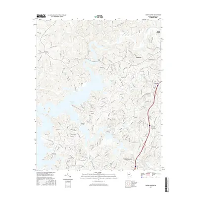
2017 Map of South Canton
USGS Topo · Published 2017About this map
Allatoona Lake dominates the central landscape of this Cherokee County study, its irregular shoreline reaching into the valleys formed by the Etowah River and Little River. The map documents the residential growth south of Canton and north of Woodstock, where subdivisions like Victoria and Univeter are established near the water's edge. Family history is preserved in localized sites such as Knox Cem and Brooks Cem, which remain as markers of the area's rural heritage amidst modern road networks like Deer Track Rd and Veterans Cemetery Rd. In the southern reaches, the corridor between Holly Springs and Lebanon shows a transition toward more dense settlement, while geographic landmarks like Gold Mill Ridge and Mosquito Flats define the underlying topography that shaped early land use before the lake's inundation.
Find a feature on this map
208 named features on this map. Tap any name to fly to it.
Don’t see what you’re looking for? This feature index may not catch every label — zoom into the map to look around manually.
Map Details
Editions of this 2017 South Canton Map
This is the sole edition of this map. No revisions or reprints were ever made.
Other maps of this area

1890 · Suwanee
USGS Topo · 1:125,000

1890 · Cartersville
USGS Topo · 1:125,000

1891 · Cartersville
USGS Topo · 1:125,000

1894 · Suwanee
USGS Topo · 1:125,000

1896 · Cartersville
USGS Topo · 1:125,000

1907 · Acworth
USGS Topo · 1:62,500

1909 · Acworth
USGS Topo · 1:62,500

1926 · Tate
USGS Topo · 1:62,500

1928 · Tate
USGS Topo · 1:62,500

1947 · Waleska
USGS Topo · 1:62,500