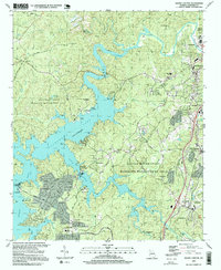
1997 Map of South Canton
USGS Topo · Published 1999About this map
The Etowah River and the expansive waters of Allatoona Lake dominate this Cherokee County landscape, defining the character of the region in the late 1990s. The map illustrates a transition from the industrial and residential centers of Canton and Holly Springs to the protected woodlands of the Allatoona State Wildlife Management Area. Transport and industry are evident through the Georgia Northern RR corridor and the developments at Univeter and Lebanon. For the local historian, the map preserves the locations of rural landmarks like Lovingood Cem and Knox Cem, along with community anchors such as Fields Chapel and New Bethel Ch. The presence of Victoria Landing and Fields Landing highlights the era's focus on lakeside recreation and infrastructure.
Find a feature on this map
56 named features on this map. Tap any name to fly to it.
Don’t see what you’re looking for? This feature index may not catch every label — zoom into the map to look around manually.
Map Details
Editions of this 1997 South Canton Map
This is the sole edition of this map. No revisions or reprints were ever made.
Other maps of this area

1890 · Suwanee
USGS Topo · 1:125,000

1890 · Cartersville
USGS Topo · 1:125,000

1891 · Cartersville
USGS Topo · 1:125,000

1894 · Suwanee
USGS Topo · 1:125,000

1896 · Cartersville
USGS Topo · 1:125,000

1907 · Acworth
USGS Topo · 1:62,500

1909 · Acworth
USGS Topo · 1:62,500

1926 · Tate
USGS Topo · 1:62,500

1928 · Tate
USGS Topo · 1:62,500

1947 · Waleska
USGS Topo · 1:62,500