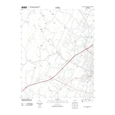
2010 Map of South Cleveland
USGS Topo · Published 2010About this map
Cleveland and its southwestern outskirts are defined by a complex network of ridges and hollows that historically shaped the region's development. Local industry and mineral exploration are evidenced by the King Mine and King Prospect in the north, while the landscape is dotted with numerous family and community burial grounds, such as Seaborn Cemetery, Fort Hill Cemetery, and Goodner Cemetery. These sites provide significant genealogical value for those researching the early families of Bradley County.
Find a feature on this map
97 named features on this map. Tap any name to fly to it.
Don’t see what you’re looking for? This feature index may not catch every label — zoom into the map to look around manually.
Map Details
Editions of this 2010 South Cleveland Map
This is the sole edition of this map. No revisions or reprints were ever made.
Other maps of this area

1886 · Cleveland
USGS Topo · 1:125,000

1888 · Chattanooga
USGS Topo · 1:125,000

1892 · Cleveland
USGS Topo · 1:125,000

1893 · Chattanooga
USGS Topo · 1:125,000

1895 · Cleveland
USGS Topo · 1:125,000

1901 · Cleveland
USGS Topo · 1:125,000

1935 · East Cleveland
USGS Topo · 1:24,000

1935 · Mc Donald
USGS Topo · 1:24,000

1935 · Felker
USGS Topo · 1:24,000

1935 · Snow Hill
USGS Topo · 1:24,000