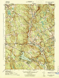
1944 Map of South Coventry
USGS Topo · Published 1944About this map
Wangumbaug Lake and the Willimantic River valley anchor this mid-century survey of Tolland County, detailing the educational and institutional growth of the region. The map captures the burgeoning University of Connecticut campus at Storrs, along with the associated University of Conn Experiment Farm. In the south, the village of South Coventry is marked by local heritage sites including the Nathan Hale Birthplace and the Nathan Hale Cem. Transport is defined by the Central Vermont railroad line, which follows the river through Merrow and Mansfield Depot to South Coventry Station. Notable local landmarks like the State Hospital and the Brick Sch indicate the distribution of public services and rural education during this era.
Find a feature on this map
47 named features on this map. Tap any name to fly to it.
Don’t see what you’re looking for? This feature index may not catch every label — zoom into the map to look around manually.
Map Details
Editions of this 1944 South Coventry Map
3 editions found
Other maps of this area

1892 · Woodstock
USGS Topo · 1:62,500

1892 · Tolland
USGS Topo · 1:62,500

1892 · Norwich
USGS Topo · 1:62,500

1892 · Gilead
USGS Topo · 1:62,500

1921 · Tolland
USGS Topo · 1:62,500

1921 · Woodstock
USGS Topo · 1:62,500

1944 · Marlboro
USGS Topo · 1:31,680

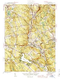
1944 · South Coventry
USGS Topo · 1:31,680

1944 · Columbia
USGS Topo · 1:31,680
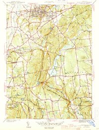
1944 · Rockville
USGS Topo · 1:31,680