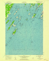
1956 Map of South Harpswell
USGS Topo · Published 1959About this map
Great Chebeague Island and the intricate archipelago of Casco Bay define this 1950s coastal survey. The map details a maritime landscape shaped by ferry routes and seasonal landings, such as Cliff Island Landing and Jenks Landing, providing a look at the area's transportation network before modern bridge developments dominated the region. On the mainland, South Harpswell serves as a primary settlement point, while the offshore islands like Jewell Island feature distinctive navigational aids, including an Observation Tower and Beacon. The seafaring economy of the mid-20th century is evident in the numerous protected anchorages like Mackerel Cove and Potts Harbor, along with soundings that chart the depths of Luckse Sound and Broad Sound. This edition integrates hydrography from the mid-1950s with topography based on earlier planetable surveys, capturing a precise moment in Maine's coastal history.
Find a feature on this map
85 named features on this map. Tap any name to fly to it.
Don’t see what you’re looking for? This feature index may not catch every label — zoom into the map to look around manually.
Map Details
Editions of this 1956 South Harpswell Map
3 editions found
Other maps of this area

1892 · Freeport
USGS Topo · 1:62,500

1893 · Small Point
USGS Topo · 1:62,500

1893 · Casco Bay
USGS Topo · 1:62,500

1894 · Bath
USGS Topo · 1:62,500

1914 · Casco Bay
USGS Topo · 1:48,000

1916 · Casco Bay
USGS Topo · 1:62,500

1916 · Portland And Vicinity
USGS Topo · 1:62,500

1918 · Portland And Vicinity
USGS Topo · 1:62,500

1919 · Small Point
USGS Topo · 1:62,500

1920 · Bath
USGS Topo · 1:62,500