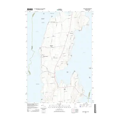
2015 Map of South Hero
USGS Topo · Published 2015About this map
Lake Champlain surrounds the islands of this northern Vermont landscape, where the communities of Grand Isle and South Hero anchor a region defined by its waterfront history. The intricate shoreline is dotted with numerous points and landings, including Gordon Landing and Adams Landing, which have historically linked these landmasses to the mainland. Family names and local legacies are preserved in the numerous cemeteries throughout the island, such as the Quaker and Macomber Cem and Hoag Cem. The map illustrates a developed network of local roads like Quaker Rd and State Park Rd that weave between agricultural parcels and the interior settlements of Pearl and Grand Isle Station. At the southern end, the Allenholm Airport and the complex geography of Keeler Bay showcase the modern infrastructure supporting this historic lakefront territory.
Find a feature on this map
87 named features on this map. Tap any name to fly to it.
Don’t see what you’re looking for? This feature index may not catch every label — zoom into the map to look around manually.
Map Details
Editions of this 2015 South Hero Map
This is the sole edition of this map. No revisions or reprints were ever made.
Other maps of this area

1894 · Plattsburg
USGS Topo · 1:62,500

1895 · Rouse Point
USGS Topo · 1:62,500

1906 · Plattsburg
USGS Topo · 1:62,500

1907 · Rouse Point
USGS Topo · 1:62,500

1913 · Milton
USGS Topo · 1:48,000

1914 · St. Albans
USGS Topo · 1:48,000

1915 · Milton
USGS Topo · 1:62,500

1916 · St. Albans
USGS Topo · 1:62,500

1939 · Rouses Point
USGS Topo · 1:62,500

1939 · Plattsburg
USGS Topo · 1:62,500