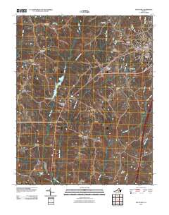
2010 Map of South Hill
USGS Topo · Published 2010About this map
South Hill serves as the primary hub of this Mecklenburg County landscape, shown here at the start of the 2010s with its established grid of streets, the South Hill Post Office, and the nearby South Hill Airfield. The surrounding countryside is defined by a network of smaller crossroads and rural settlements such as Union Level, Lombardy Grove, and Smiths Crossroads. Genealogists will find numerous family and community burial grounds, including Saint Pauls Cemetery, West View Cemetery, and Oakwood Cemetery. The hydrology of the region is marked by several man-made structures like Jeffreys Number One Dam and Lake Gordons Dam, which manage the flow of Miles Creek and its tributaries as they move toward the southern border of the quadrangle near Invermay.
Find a feature on this map
36 named features on this map. Tap any name to fly to it.
Don’t see what you’re looking for? This feature index may not catch every label — zoom into the map to look around manually.
Map Details
Editions of this 2010 South Hill Map
This is the sole edition of this map. No revisions or reprints were ever made.
Other maps of this area

1953 · Greensboro
USGS Topo · 1:250,000

1954 · Greensboro
USGS Topo · 1:250,000

1955 · Chase City
USGS Topo · 1:62,500

1955 · Kenbridge
USGS Topo · 1:62,500

1955 · Boydton
USGS Topo · 1:62,500

1962 · Greensboro
USGS Topo · 1:250,000

1966 · Greensboro
USGS Topo · 1:250,000
1966 · Wightman
USGS Topo · 1:24,000
1966 · North View
USGS Topo · 1:24,000
1966 · Forksville
USGS Topo · 1:24,000