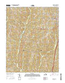
2016 Map of South Hill
USGS Topo · Published 2016About this map
The town of South Hill serves as the primary hub of this Mecklenburg County landscape, where the street grid expands near the intersection of several key routes. The surrounding countryside is defined by several smaller historical settlements, including Union Level, Lombardy Grove, and Dockery, many of which grew around crossroads and early post office locations. The terrain is marked by the drainage basins of Miles Creek and Flat Creek, which weave through a network of rural roads such as Plank Rd and Skyline Rd.
Find a feature on this map
90 named features on this map. Tap any name to fly to it.
Don’t see what you’re looking for? This feature index may not catch every label — zoom into the map to look around manually.
Map Details
Editions of this 2016 South Hill Map
This is the sole edition of this map. No revisions or reprints were ever made.
Other maps of this area

1953 · Greensboro
USGS Topo · 1:250,000

1954 · Greensboro
USGS Topo · 1:250,000

1955 · Chase City
USGS Topo · 1:62,500

1955 · Kenbridge
USGS Topo · 1:62,500

1955 · Boydton
USGS Topo · 1:62,500

1962 · Greensboro
USGS Topo · 1:250,000

1966 · Greensboro
USGS Topo · 1:250,000
1966 · Wightman
USGS Topo · 1:24,000
1966 · North View
USGS Topo · 1:24,000
1966 · Forksville
USGS Topo · 1:24,000