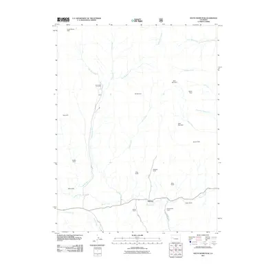
2011 Map of South Mamm Peak
USGS Topo · Published 2011About this map
Heiberger sits at the southern edge of this Western Slope landscape, where the confluence of several prominent gulches meets the broader valley of Buzzard Creek. The geography is defined by a series of steep drainages including Standup Gulch, Slide Gulch, and Groundhog Gulch, all descending from the high ridges of South Mamm Peak and Bald Mountain.
Find a feature on this map
38 named features on this map. Tap any name to fly to it.
Don’t see what you’re looking for? This feature index may not catch every label — zoom into the map to look around manually.
Map Details
Editions of this 2011 South Mamm Peak Map
This is the sole edition of this map. No revisions or reprints were ever made.
Other maps of this area

1955 · Collbran
USGS Topo · 1:24,000

1955 · The Meadows
USGS Topo · 1:24,000

1957 · Leadville
USGS Topo · 1:250,000

1959 · Leadville
USGS Topo · 1:250,000

1960 · Leadville
USGS Topo · 1:250,000

1960 · North Mamm Peak
USGS Topo · 1:24,000
1960 · Hawxhurst Creek
USGS Topo · 1:24,000

1960 · South Mamm Peak
USGS Topo · 1:24,000
1960 · Rulison
USGS Topo · 1:24,000

1961 · Porter Mountain
USGS Topo · 1:24,000