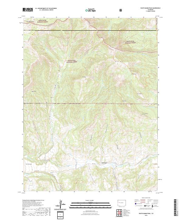
2022 Map of South Mamm Peak
USGS Topo · Published 2022About this map
The rugged high-elevation terrain of White River National Forest and Grand Mesa National Forest dominates this Western Slope landscape. Settlement is concentrated along the southern valley floor near Heiberger, where the drainage of Buzzard Cr creates a pocket of navigable land beneath the looming summits of South Mamm Peak and Elk Mtn. The transport network relies on a system of forest trails and rural roads like Vega Dam Rd and Peninsula Rd, which skirt the base of prominent landforms such as The Peninsula.
Find a feature on this map
51 named features on this map. Tap any name to fly to it.
Don’t see what you’re looking for? This feature index may not catch every label — zoom into the map to look around manually.
Map Details
Editions of this 2022 South Mamm Peak Map
This is the sole edition of this map. No revisions or reprints were ever made.
Other maps of this area

1955 · Collbran
USGS Topo · 1:24,000

1955 · The Meadows
USGS Topo · 1:24,000

1957 · Leadville
USGS Topo · 1:250,000

1959 · Leadville
USGS Topo · 1:250,000

1960 · Leadville
USGS Topo · 1:250,000

1960 · North Mamm Peak
USGS Topo · 1:24,000
1960 · Hawxhurst Creek
USGS Topo · 1:24,000

1960 · South Mamm Peak
USGS Topo · 1:24,000
1960 · Rulison
USGS Topo · 1:24,000

1961 · Porter Mountain
USGS Topo · 1:24,000