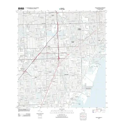
1994 Map of South Miami
USGS Topo · Published 2000About this map
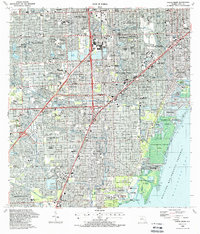
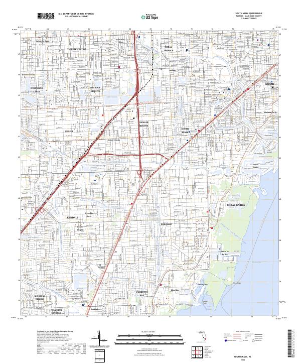
Coral Gables and the sprawling University of Miami campus anchor the northern reaches of this mid-1990s coastal survey, revealing a landscape defined by dense suburban integration and extensive public green space. The shoreline of the Biscayne Bay Aquatic Preserve is dominated by significant preserves and landmarks, including the historic Matheson Hammock County Park and the Deering Estate, which contrast with the engineered canals like Snapper Creek Canal. Inland, the commercial hub of Kendall is visible near the intersection of major thoroughfares like the Palmetto Expressway, while the Metrorail line provides a modern transit corridor through South Miami. Local history is captured in the numerous neighborhood schools and landmarks, such as the Parrot Jungle amusement park and the specialized USDA Horticultural Research Station, which reflect the region's diverse institutional and recreational development during this era.
Find a feature on this map
140 named features on this map. Tap any name to fly to it.
Don’t see what you’re looking for? This feature index may not catch every label — zoom into the map to look around manually.
Map Details
Editions of this 1994 South Miami Map
This is the sole edition of this map. No revisions or reprints were ever made.
Historical Maps of Miami Through Time
9 maps found
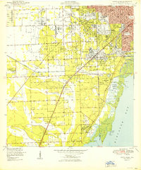
1950 South Miami
Miami-Dade County, FL
1956 South Miami
Miami-Dade County, FL
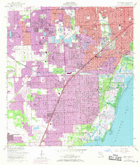
1988 South Miami
Miami-Dade County, FL
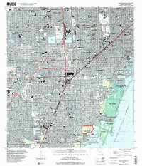
1994 South Miami
Miami-Dade County, FL
2012 South Miami
Miami-Dade County, FL
2015 South Miami
Miami-Dade County, FL
2018 South Miami
Miami-Dade County, FL
2021 South Miami
Miami-Dade County, FL
2024 South Miami
Miami-Dade County, FL