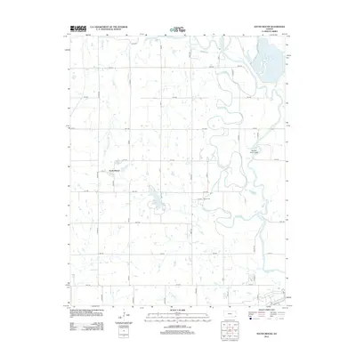
2012 Map of South Mound
USGS Topo · Published 2012About this map
Neosho River dominates the eastern landscape of this Neosho County region, winding through a complex of oxbows and secondary channels including the Neosho River Cutoff. The small community of South Mound sits in the western portion of the map, serving as a focal point for a grid of rural roads that connect local family lands. This 2012 survey illustrates the hydrological character of the area, where tributaries like Bachelor Cr and Tolen Cr feed into the river system. Local history and genealogy interests are centered at Brown Cem, situated near the center of the quadrangle. The presence of Lake McKinley further highlights the importance of water management in this agricultural prairie setting, providing a clear record of the terrain before further 21st-century development.
Find a feature on this map
37 named features on this map. Tap any name to fly to it.
Don’t see what you’re looking for? This feature index may not catch every label — zoom into the map to look around manually.
Map Details
Editions of this 2012 South Mound Map
This is the sole edition of this map. No revisions or reprints were ever made.
Other maps of this area

1886 · Iola
USGS Topo · 1:125,000

1886 · Parsons
USGS Topo · 1:125,000

1893 · Iola
USGS Topo · 1:125,000

1893 · Parsons
USGS Topo · 1:125,000

1904 · Iola
USGS Topo · 1:125,000

1943 · McCune
USGS Topo · 1:62,500

1945 · Mc Cune
USGS Topo · 1:62,500

1945 · Parsons
USGS Topo · 1:62,500

1946 · Parsons
USGS Topo · 1:62,500

1947 · Parsons
USGS Topo · 1:62,500