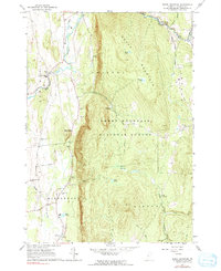
1963 Map of South Mountain
USGS Topo · Published 1991About this map
New Haven Mills and West Lincoln anchor the northern reaches of this landscape, situated where the New Haven River cuts through the transition between the Champlain Valley and the higher elevations of the Green Mountain National Forest. The map captures a detailed view of the rural infrastructure of Addison County in the early 1960s, showing a network of gravel pits and local waterworks, including the Middlebury Waterworks and Middlebury Water Supply.
Find a feature on this map
45 named features on this map. Tap any name to fly to it.
Don’t see what you’re looking for? This feature index may not catch every label — zoom into the map to look around manually.
Map Details
Editions of this 1963 South Mountain Map
3 editions found
Other maps of this area

1902 · Brandon
USGS Topo · 1:62,500

1903 · Middlebury
USGS Topo · 1:62,500

1904 · Brandon
USGS Topo · 1:62,500

1905 · Middlebury
USGS Topo · 1:62,500

1915 · Rochester
USGS Topo · 1:62,500

1917 · Rochester
USGS Topo · 1:62,500

1919 · Lincoln Mountain
USGS Topo · 1:62,500

1920 · Lincoln Mountain
USGS Topo · 1:48,000

1920 · Brandon
USGS Topo · 1:62,500

1920 · Middlebury
USGS Topo · 1:62,500