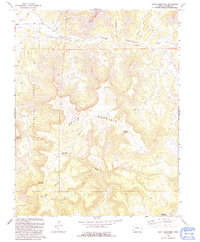
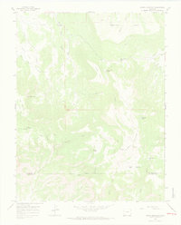
1993 Map of South Mountain
USGS Topo · Published 1993About this map
South Mountain dominates this portion of the San Juan National Forest in Dolores County, where a network of water management features and high-altitude plateaus define the landscape. The northern reaches are shaped by Disappointment Creek and its tributaries, including Alkali Wash and Salt Arroyo. Evidence of early water engineering is visible through labels for a Flume and Siphon near the creek's path. For genealogists and local historians, the inclusion of Nash Cem provides a specific point of interest in an otherwise sparsely settled region of the San Miguel Mountains. The southern terrain transitions into the broad expanse of Lone Mesa, supported by water sources such as Lone Mesa Reservoir and Lone Mesa Spring No 1. The map also captures several prominent peaks, including Thomas Mountain and Belmear Mountain, alongside numerous 4WD tracks that suggest the area's continued use for resource management and access.
Find a feature on this map
21 named features on this map. Tap any name to fly to it.
Don’t see what you’re looking for? This feature index may not catch every label — zoom into the map to look around manually.
Map Details
Editions of this 1993 South Mountain Map
This is the sole edition of this map. No revisions or reprints were ever made.
Other maps of this area

1956 · Cortez
USGS Topo · 1:250,000

1958 · Cortez
USGS Topo · 1:250,000

1959 · Cortez
USGS Topo · 1:250,000

1962 · Cortez
USGS Topo · 1:250,000
1963 · Nipple Mountain
USGS Topo · 1:24,000
1964 · Groundhog Reservoir
USGS Topo · 1:24,000
1964 · Lone Cone
USGS Topo · 1:24,000

1964 · Glade Mountain
USGS Topo · 1:24,000
1964 · North Mountain
USGS Topo · 1:24,000

1964 · Mc Kenna Peak
USGS Topo · 1:24,000