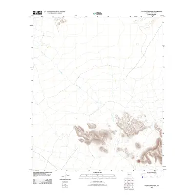
2011 Map of South of Sentinel
USGS Topo · Published 2011About this map
Tenmile Wash dominates this arid landscape south of Sentinel, carving a complex drainage network across the desert floor of Maricopa County. This 2011 survey by the U.S. Geological Survey illustrates the stark hydrological patterns of the region, where ephemeral watercourses define the topography. The map's detail focuses on the subtle contours of the basin, showing how numerous small tributaries converge into the primary channel of the wash as it trends toward the northwest. For those studying the environmental history or physical geography of southwestern Arizona, the sheet provides a precise record of the drainage patterns and desert terrain before modern development or significant shifts in the local water table altered these ancient desert landmarks.
Find a feature on this map
1 named feature on this map. Tap any name to fly to it.
Don’t see what you’re looking for? This feature index may not catch every label — zoom into the map to look around manually.
Map Details
Editions of this 2011 South of Sentinel Map
This is the sole edition of this map. No revisions or reprints were ever made.
Other maps of this area

1927 · Aguila Mountains
USGS Topo · 1:48,000

1929 · Aztec
USGS Topo · 1:62,500

1930 · Aguila Mountains
USGS Topo · 1:62,500

1949 · Sentinel
USGS Topo · 1:62,500

1950 · Sentinel
USGS Topo · 1:62,500

1950 · Aztec
USGS Topo · 1:62,500

1953 · Ajo
USGS Topo · 1:250,000

1957 · Ajo
USGS Topo · 1:250,000

1958 · Ajo
USGS Topo · 1:250,000

1962 · Ajo
USGS Topo · 1:250,000