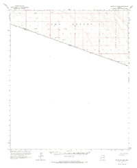
1964 Map of South of Yuma
USGS Topo · Published 1966About this map
The Yuma Desert dominates this arid landscape along the international border, as surveyed in the early 1960s. The map illustrates the sparsely populated expanse where the United States-Mexico boundary line cuts southeast across the desert floor toward the Arizona-Sonora line. Human activity is largely confined to utility and exploration, evidenced by several scattered Test Wells and a solitary Jeep Trail winding through the sand.
Find a feature on this map
9 named features on this map. Tap any name to fly to it.
Don’t see what you’re looking for? This feature index may not catch every label — zoom into the map to look around manually.
Map Details
Editions of this 1964 South of Yuma Map
This is the sole edition of this map. No revisions or reprints were ever made.
Other maps of this area

1903 · Yuma
USGS Topo · 1:125,000

1905 · Yuma
USGS Topo · 1:125,000

1926 · Fortuna
USGS Topo · 1:62,500

1929 · Fortuna
USGS Topo · 1:62,500

1940 · Yuma
USGS Topo · 1:62,500

1942 · Yuma
USGS Topo · 1:250,000

1945 · Yuma
USGS Topo · 1:62,500

1954 · El Centro
USGS Topo · 1:250,000

1955 · El Centro
USGS Topo · 1:250,000

1958 · El Centro
USGS Topo · 1:250,000