
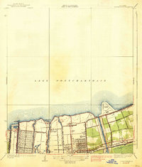
1936 Map of South Point
USGS Topo · Published 1936About this map
Lake Pontchartrain dominates this mid-1930s coastal survey, illustrating the watery boundary between St Tammany Parish and Orleans Parish. The landscape is largely defined by the shoreline of the lake and the marshy reaches of Irish Lagoon, where the land meets the water at precise points like Pt Platte and Pt au Chien. This edition is particularly notable for incorporating early aerial photography compiled by the Army Air Corps to map the intricate drainage and shoreline features that were difficult to survey from the ground.
Find a feature on this map
10 named features on this map. Tap any name to fly to it.
Don’t see what you’re looking for? This feature index may not catch every label — zoom into the map to look around manually.
Map Details
Editions of this 1936 South Point Map
This is the sole edition of this map. No revisions or reprints were ever made.
Other maps of this area

1891 · Spanish Fort
USGS Topo · 1:62,500

1892 · Chef Menteur
USGS Topo · 1:62,500

1935 · Slidell
USGS Topo · 1:62,500

1935 · Covington
USGS Topo · 1:62,500

1936 · North Shore
USGS Topo · 1:31,680

1936 · Chef Menteur
USGS Topo · 1:62,500

1936 · Spanish Fort
USGS Topo · 1:62,500

1937 · Chef Menteur
USGS Topo · 1:31,680

1938 · Little Woods
USGS Topo · 1:31,680
1938 · Spanish Fort
USGS Topo · 1:31,680