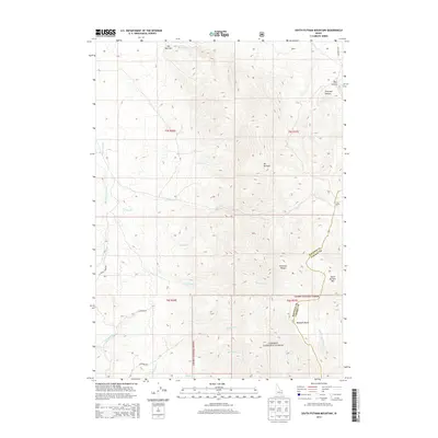
2013 Map of South Putnam Mountain
USGS Topo · Published 2013About this map
Mt Putnam and the high peaks of the Portneuf Range dominate this section of the Caribou National Forest in southeastern Idaho. The landscape is defined by its complex drainage systems, where Ross Fork and its southern fork wind through deep topographic breaks like The Narrows. At the south of the sheet, South Putnam Mtn rises above Buckskin Basin, marking a significant elevation gain from the northern creek beds. The map documents a network of forest and access roads, including Jeff Cabin Rd and W McKee Rd, which provide entry into the various canyons and basins. Water features such as Thirty Day Cr, Farmer Cr, and the Smoke Lateral indicate a terrain where seasonal and managed water flow is essential to the local geography.
Find a feature on this map
32 named features on this map. Tap any name to fly to it.
Don’t see what you’re looking for? This feature index may not catch every label — zoom into the map to look around manually.
Map Details
Editions of this 2013 South Putnam Mountain Map
This is the sole edition of this map. No revisions or reprints were ever made.
Other maps of this area

1937 · Pocatello
USGS Topo · 1:48,000

1940 · Blackfoot
USGS Topo · 1:62,500

1943 · Blackfoot
USGS Topo · 1:62,500

1944 · Pocatello
USGS Topo · 1:62,500

1954 · Pocatello
USGS Topo · 1:250,000

1955 · Yandell Springs
USGS Topo · 1:62,500

1955 · Idaho Falls
USGS Topo · 1:250,000

1958 · Idaho Falls
USGS Topo · 1:250,000

1958 · Pocatello
USGS Topo · 1:250,000

1968 · Bear Camp Gulch
USGS Topo · 1:24,000