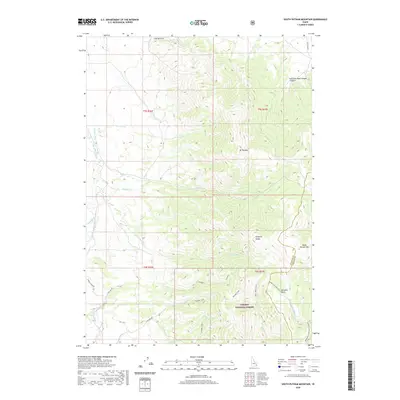
2020 Map of South Putnam Mountain
USGS Topo · Published 2020About this map
Mt Putnam and South Putnam Mtn anchor the high elevations of the Portneuf Range in this section of Bannock and Caribou Counties. The landscape is defined by the steep drainage systems of the Caribou National Forest, where numerous creeks including Ross Fork, Thirty Day Cr, and Mcnabe Creek carve through the mountain terrain. In the northwest, The Narrows marks a distinctive topographical pinch point along the upper Ross Fork valley.
Find a feature on this map
36 named features on this map. Tap any name to fly to it.
Don’t see what you’re looking for? This feature index may not catch every label — zoom into the map to look around manually.
Map Details
Editions of this 2020 South Putnam Mountain Map
This is the sole edition of this map. No revisions or reprints were ever made.
Other maps of this area

1937 · Pocatello
USGS Topo · 1:48,000

1940 · Blackfoot
USGS Topo · 1:62,500

1943 · Blackfoot
USGS Topo · 1:62,500

1944 · Pocatello
USGS Topo · 1:62,500

1954 · Pocatello
USGS Topo · 1:250,000

1955 · Yandell Springs
USGS Topo · 1:62,500

1955 · Idaho Falls
USGS Topo · 1:250,000

1958 · Idaho Falls
USGS Topo · 1:250,000

1958 · Pocatello
USGS Topo · 1:250,000

1968 · Bear Camp Gulch
USGS Topo · 1:24,000